 In this mode, a foundational
map is presented and in a series of click thrus, that map is drilled
down to smaller spatial scales and to no information levels. This kind of
approach is appealing to those that believe information should be
stored and accessed in a hierarchical manner. I strongly suspect this is
the approach we would adopt here as its pretty standard. The downside of this approach
is two-fold:
In this mode, a foundational
map is presented and in a series of click thrus, that map is drilled
down to smaller spatial scales and to no information levels. This kind of
approach is appealing to those that believe information should be
stored and accessed in a hierarchical manner. I strongly suspect this is
the approach we would adopt here as its pretty standard. The downside of this approach
is two-fold:
- Designers can get carried away with the number of hierarchical levels
that represent information so that the user does a lot of clicking.
- The information is never shown in a connected way on one interface (e.g. one web page).
A good example of this drill down approach can be found
here for the case of the University of Missouri (Click on the MU Flagship Campus
area and go from there).
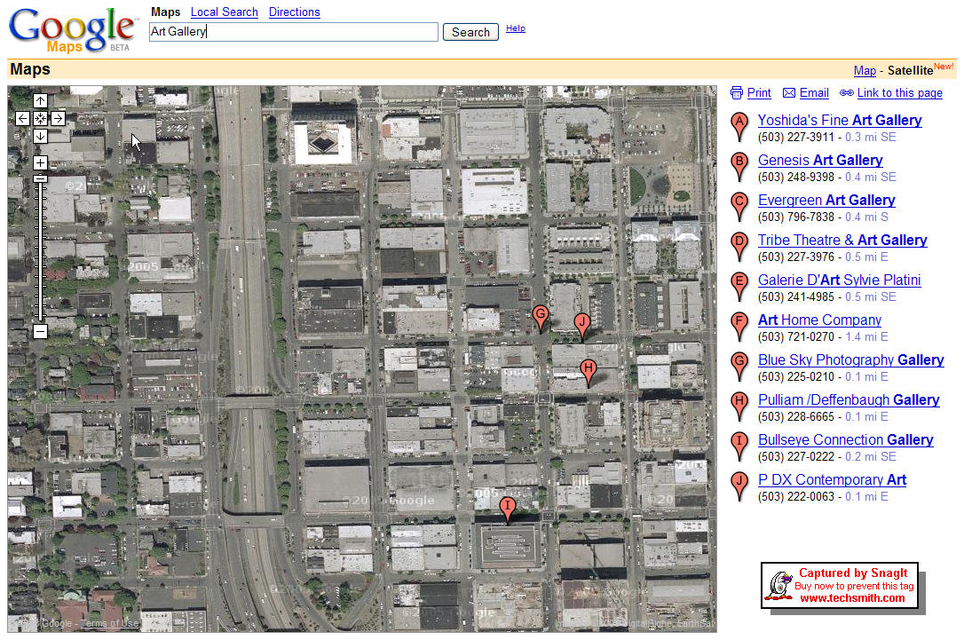
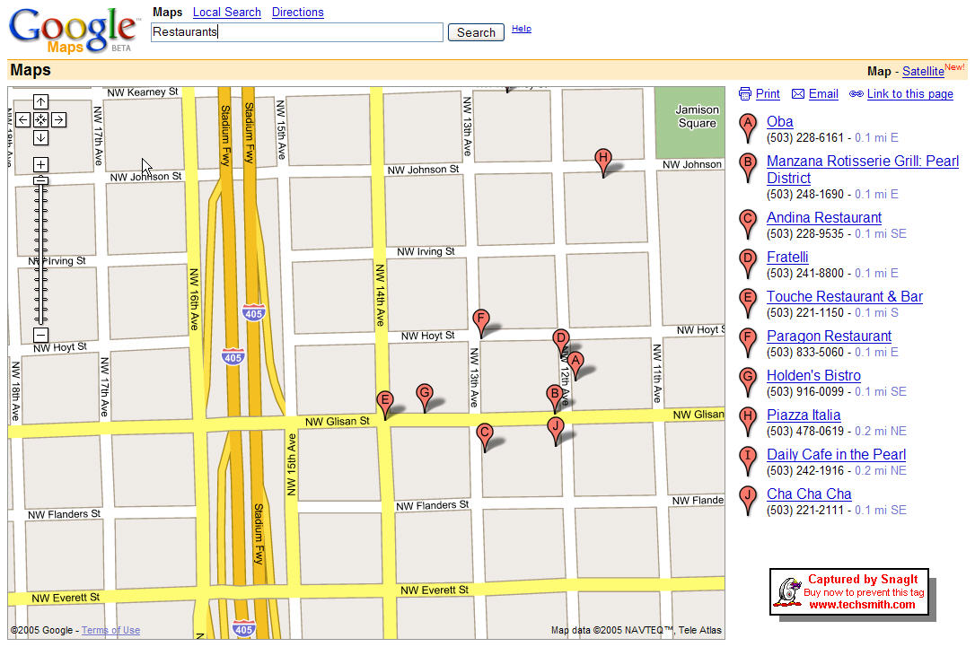
This is the approach adopted by maps.google.com . Integrated with searchable database and
manually zoomable, the user types in a string and locations are shown. In principle
this is a very powerful interface (which is why Google Maps choose it) as its quite
versatile. The key to the success of this approach lies in how robustly the database
can be queried to generate an overlay. The underlying map could be a satellite photo
or a street map. Below I show two examples for the Pearl District. One that
overlays the location of Art Gallery's on a satellite photo and the other that shows
a restauraunt overlay on a street map.