Broad averages for the US are shown below:
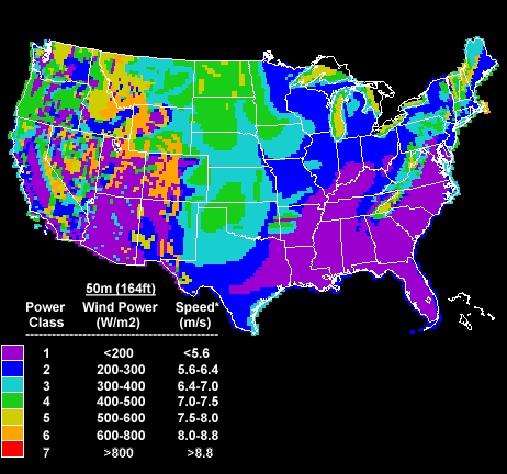
Broad averages for the US are shown below:
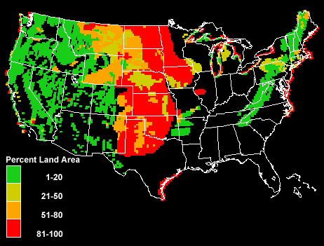
Another way to visualize the resource is to examine the percentage of land, on a state by state basis, that is rated at Class 3 and above. The red areas in the map below are clear indicators of where to plant wind farms:
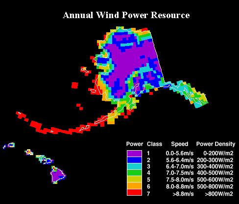
Alaska also has a serious wind resource:
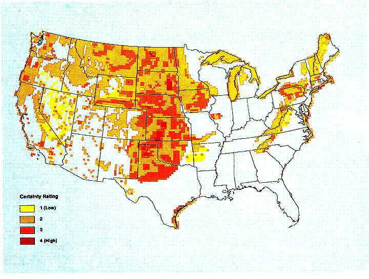
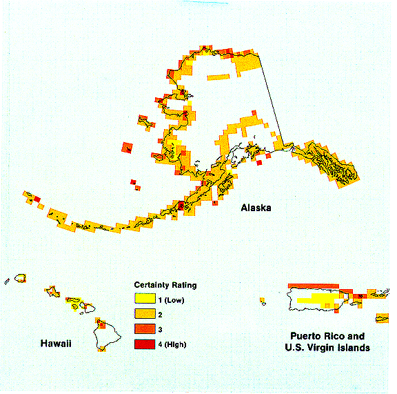
Well, it's not enough to know that the wind can blow hard in some location. The bigger question is related to the reliability of the wind source (Is it blowing all of the time? Some of the time? or just a little while ...?). The following is the wind reliability map for all Class 3 and higher sites, rated on this kind of qualitative scale. Again, red colors are the best and there are many large scale areas in red:
Alaska is good:
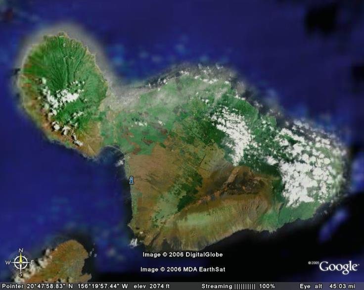
One of the more interesting natural wind alleys in the world is on the Island of Maui. The broad lowland "valley" separating the two halves of Maui has steady 20-30 mph winds blowing through it. Maui could easily create enough electricity to power the entire island by developing this resource:
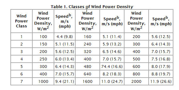
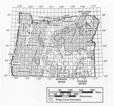
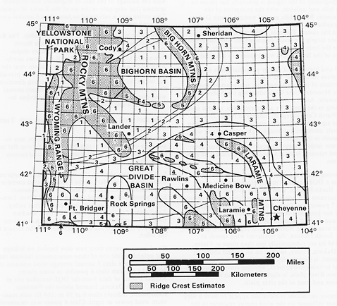
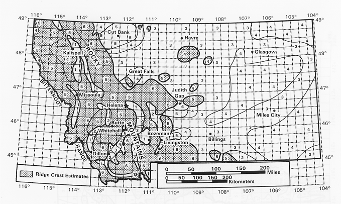
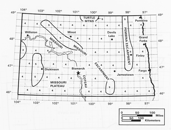
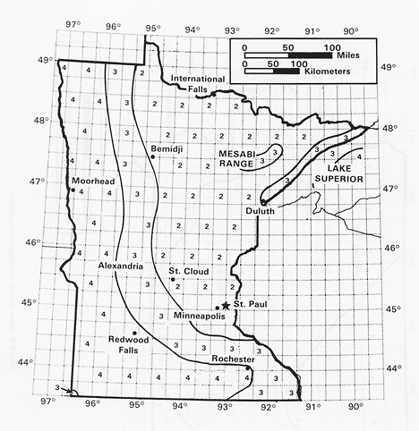
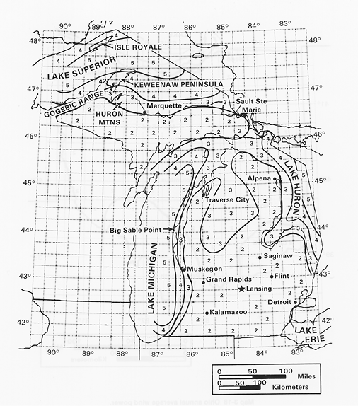
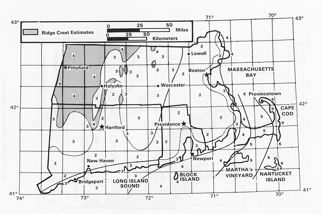
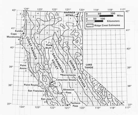
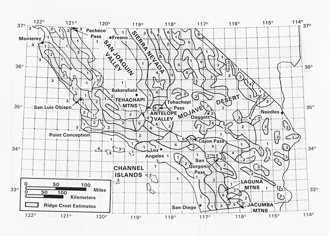
Below are gridded maps that show the wind class site per grid
for various states. These are important for identifying present and
future wind deployment. However, in the US, the current rate of wind deployment
is limited by access to extant transmission line infrastructure. This is the single
biggest reason for why the robust wind resource in the Aleutian Islands and in
North Dakota is currently being harvested with 0% efficiency. There is simply
no access to the grid at these locations. Therefore, unless we get more creative
in the future about extending the grid, or using hydrogen produced on site and then
transported (through pipeline, train, whatever) as a carrier of electricity, we will
never properly develop the innate wind resource in the US.
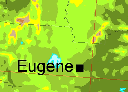
Oregon
Wyoming
Montana
North Dakota
Minnesota
Michigan
Massachusetts
California
Local Wind Resource at Coburg Ridge: