 Therefore, one definition of a heatwave is the warmest
average minimum temperatures over three consecutive nights in a given year
A recent comprehensive study (released in December 2007) has identified 4 major probable regional climate changes in the continental United States:
We start with the Midwest Scenario:
In July 1995, Chicago experienced three consecutive nights of very hot temperatures (not getting below 80); in total, nearly 700 more people
died than statistically expected  Therefore, one definition of a heatwave is the warmest
average minimum temperatures over three consecutive nights in a given year
Model results show the following for various urban centers:
Wild Fires in the American West
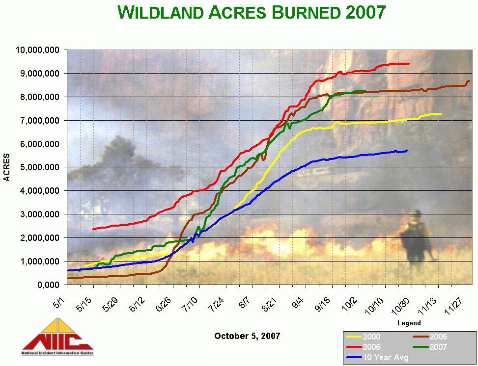

The wild fire problem is the result of two conditions. 1) Post 1950 fire supression techniques have resulted in unnaturally high biomass per unit acre in most western forests; 2) Long hot dry summers
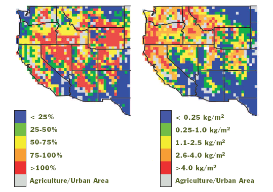
Areas coded in yellow and higher represent signficant areas of elevated risk for extensive forest fires:
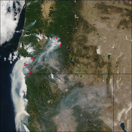
 Sidebar: The globe really is being monitored on a daily basis - if your clued into these sources,
it will help raise awareness of the condition of the planet.
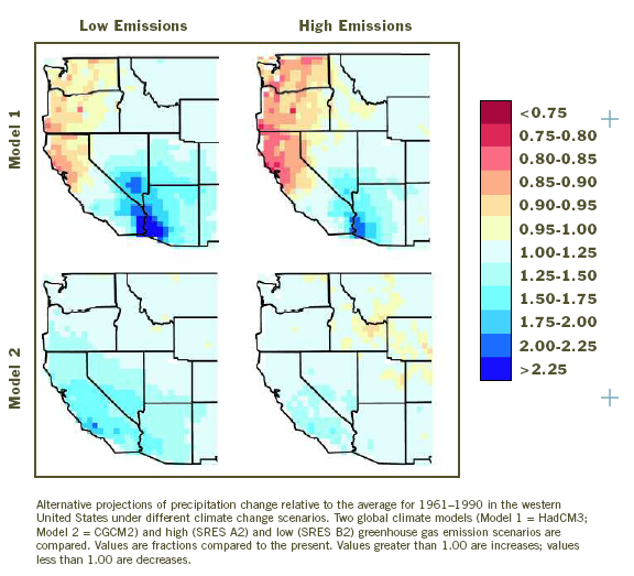
Modeling future precipation patterns in the United States is difficult. There is a not well-known summer Moonsoon season that strongly affects Arizona and less strongly, Utah and Nevada. Some models show this increasing, some decreasing. The worst case scenario (upper right) suggests significantly reduced precipation in the Pacific Northwest.
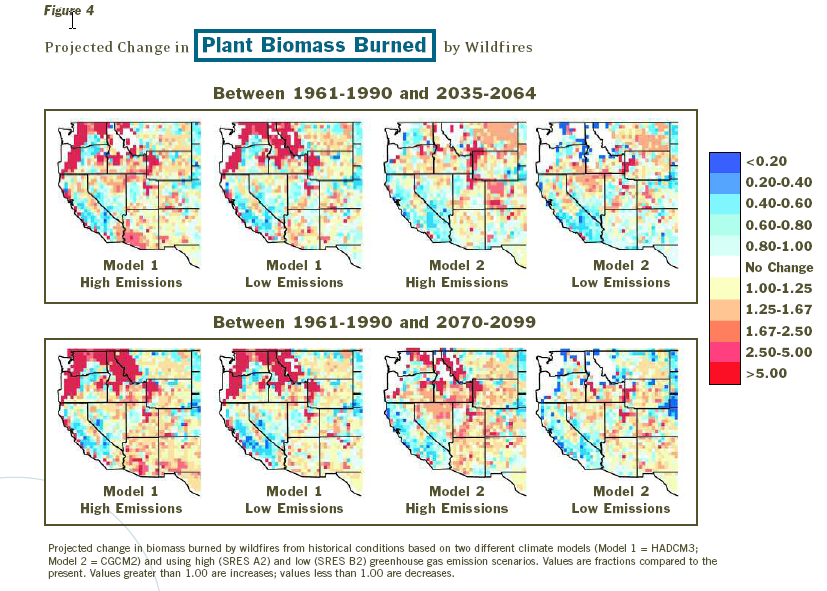
But the PNW seems most at risk:
Gulf Coast Wetlands:
Change is a consequence of rising sea levels couple with potentially greater storm and storm surge damage.
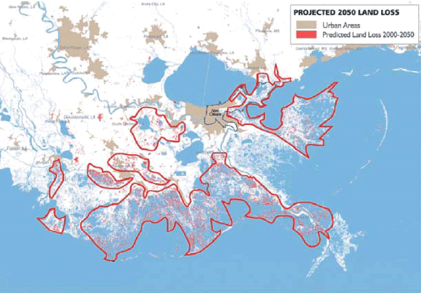
The overall amplitude of the effect is difficult to gauge but some of the expected changes are:
