Resources to use:
As mentioned in class, the University of Oregon Campus is close to two very local sites with high wind capacity. These sites have measured wind resource in the Class 5 level but only on scale of a few km. Nonetheless, in principle, one could put 3-4 1.8 MW turbines at these locations.
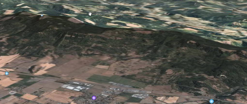
One of these is well known as the Coburg ridge (where current TV transmitting towers are located). That area, as rendered in Google Earth, is shown below (note the blue dot on the ridge top is one of the existing transmission towers):
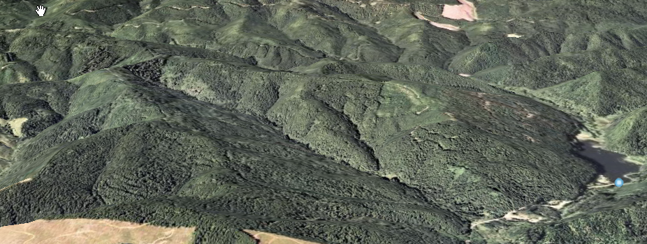
However, a lesser known site is also within 30 miles of campus and is in the western foothill ridges of the Oregon Coast Range above a reservoir called Horton Reservoir:
Your assignment is to use the the above resources and find 3 college campus in the US, of size similar to the UO, that could, in principle, make use of a large but very local wind resource.
You will need to use the Resource Atlas to identify local sources such as that shown below (which correspond to the two sites close to the UO, previously identified:
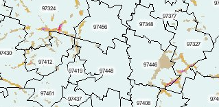
Note the atlas viewer is painful to use and the interface remains clunky but the idea is to identify similar small scale areas in purple on that map, located within 30 miles of your chosen universities (3 of them). Then try and identify that location in Google Earth and then make a screen capture of that. If your having difficult with that, then just recording the latitude and longitude and describing the location will also suffice. Note that the resource maps.huge.info is good if you need to match up the zip code map that the resource atlas viewer will give you. Resource Atlas Viewer (you are to select the resource labeled 200m to 1km Wind)
As mentioned in class, the University of Oregon Campus is close to two very local sites with high wind capacity. These sites have measured wind resource in the Class 5 level but only on scale of a few km. Nonetheless, in principle, one could put 3-4 1.8 MW turbines at these locations.
One of these is well known as the Coburg ridge (where current TV transmitting towers are located). That area, as rendered in Google Earth, is shown below (note the blue dot on the ridge top is one of the existing transmission towers):
However, a lesser known site is also within 30 miles of campus and is in the western foothill ridges of the Oregon Coast Range above a reservoir called Horton Reservoir:
Your assignment is to use the the above resources and find 3 college campus in the US, of size similar to the UO, that could, in principle, make use of a large but very local wind resource.
You will need to use the Resource Atlas to identify local sources such as that shown below (which correspond to the two sites close to the UO, previously identified:
Note the atlas viewer is painful to use and the interface remains clunky but the idea is to identify similar small scale areas in purple on that map, located within 30 miles of your chosen universities (3 of them). Then try and identify that location in Google Earth and then make a screen capture of that. If your having difficult with that, then just recording the latitude and longitude and describing the location will also suffice. Note that the resource maps.huge.info is good if you need to match up the zip code map that the resource atlas viewer will give you.
And your not allowed to select the following Universities for this exercise because they are too easy