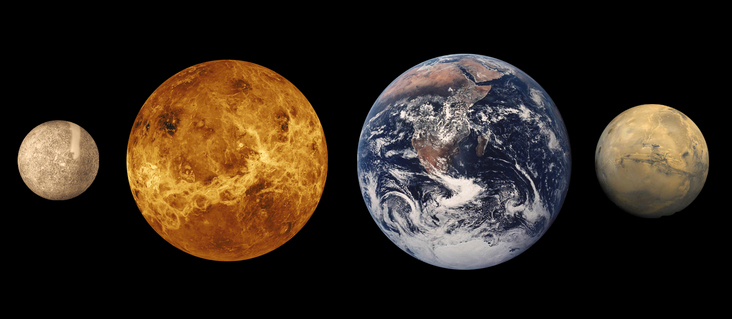
The Planet Mars

Mars is relatively small, having only about 10% the mass of the Earth
The atmosphere made up mostly of Carbon Dioxide
but its pressure is only 1% of the Earth's atmospheric pressure. Thus Mars has 10,000 times less Carbon Dioxide in its atmosphere than Venus
Martian day is 24 hours and 40 minutes long
Temperatures can vary between -200 and 80 degrees farenheit.
Mars is tilted on its axis by 25 degrees, very similar to the Earth and hence
Mars has seasonal variations
These seasonal variations cause frozen carbon dioxide to sublime from the Polar Caps thus giving Mars a seasonal atmospheric pressure
Surface features of Mars are continually augmented and eroded by wind and periodic dust storms.
Mars has two small satellites called Phobos and Deimos
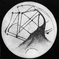
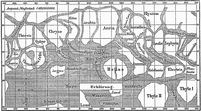
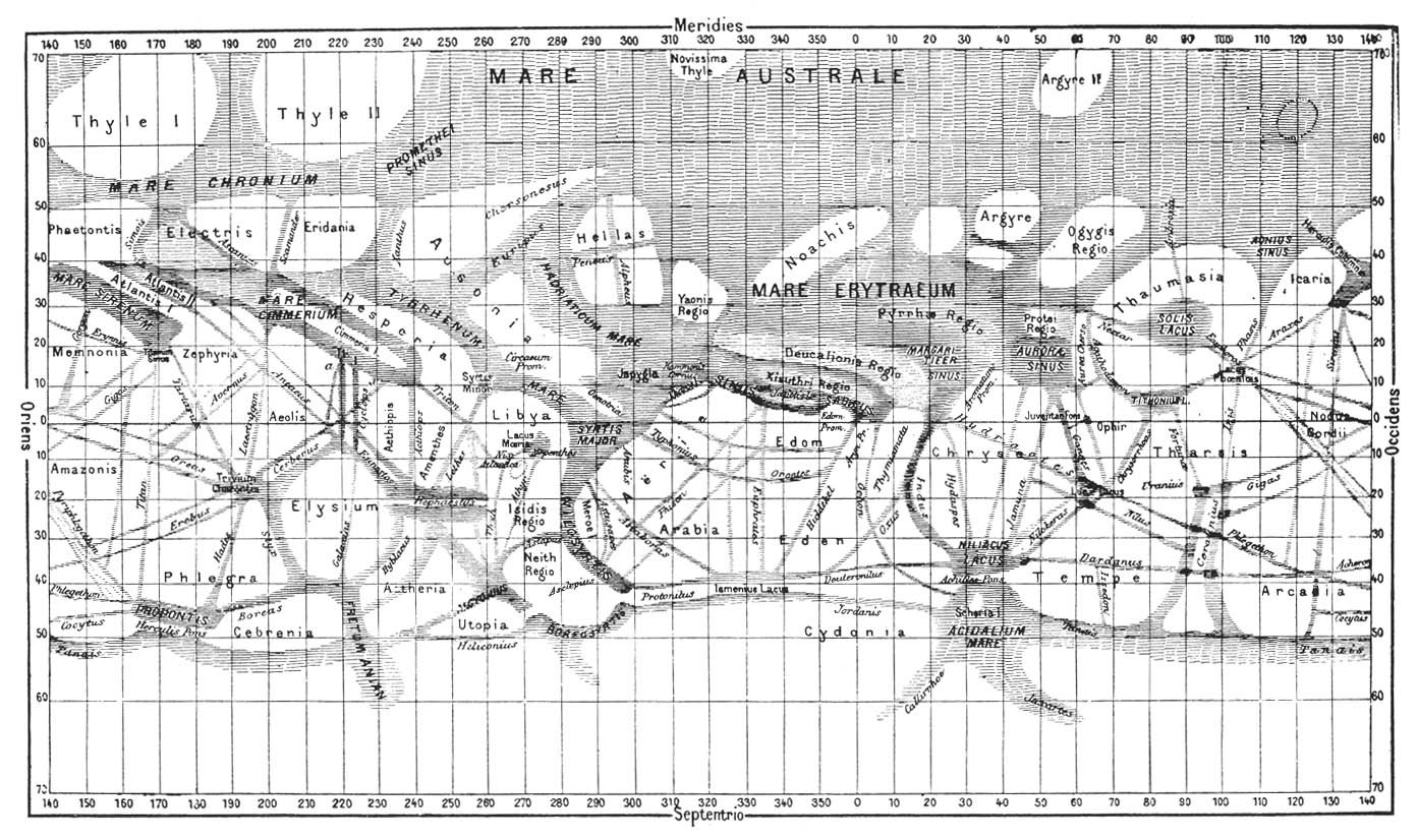
As a result, this has fueled much speculation about life on Mars. Here are a few highlights and outcomes:
This imaginative and highly inaccurate speculation about Mars has sparked the desire to
explore the Red planet with several missions to Mars...including the most current one
aptly named
"Curiosity".
In the past 15 years, Mars has been the target of several missions from NASA/JPL with the
global mission of finding evidence of water existing in the past and present as well as life or having
the potential for life. The first of these missions, Mars Global surveyor and
Pathfinder were preliminary experiments to look for
optimal areas on the surface for further study and to test the use of a robotic rover on Mars.
The next successful mission,
Phoenix lander sought evidence of water by analyzing soil samples with
an onboard laboratory.
Spirit and Opportunity
rovers sent back several images of the soil and overall geology of Mars.
Curiosity has recently landed and like Phoenix, has an onboard laboratory to analyze soil
samples and look for amino acids - the building blocks of life. You may wonder why
so many similar missions have been sent to Mars, well the answer is simply that Mars is a big place. It requires survey satellite missions to efficiently scan regions for optimal water
discovery sites and more than one rover is needed to investigate the planet.
The rovers that have landed have
exceeded their lifetimes, but there are some conditions, such as sub zero temperatures, that make
it hard on instruments to survive many years. They can only travel so far in their limited life
times. Also, one location will not give the entire picture of the planets geologic history, therefore several rovers are sent - Earthlings invading Mars!
Early Spacecraft Encounters with Mars
Recent Encounters with Mars
Surface Geology and Features on Mars

Although Valles Marineris originated as a tectonic structure, it has been modified by other processes.

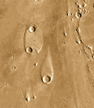
This image of the head of Ravi Vallis shows a 300-kilometer long portion of a channel. Like many other channels that empty into the northern plains of Mars, Ravi Vallis originates in a region of collapsed and disrupted ("chaotic") terrain within the planet's older, cratered highlands. Structures in these channels indicate that they were carved by liquid water moving at high flow rates. The abrupt beginning of the channel, with no apparent tributaries, suggests that the water was released under great pressure from beneath a confining layer of frozen ground. As this water was released and flowed away, the overlying surface collapsed, producing the disruption and subsidence shown here.
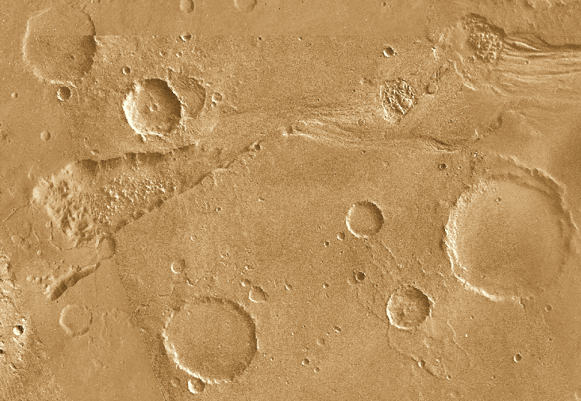
 The water that carved the channels to the north and east of the Valles Marineris canyon
system had tremendous erosive power. One consequence of this erosion was the
formation of streamlined islands where the water encountered obstacles along its path.
This image shows two streamlined islands that formed as the water was diverted by
two 8-10 kilometer diameter craters lying near the mouth of Ares Vallis in Chryse Planitia.
The water flowed from south to north (bottom to top of the image).
The height of the scarp surrounding the upper island is about 400 meters,
while the scarp surrounding the southern island is about 600 meters high.
There is a great deal of evidence of the existence of liquid water on Mars,
at least in the far past. A secondary atmosphere for all terrestrial worlds is rich in
CO2, H2O and SO2.
On Earth, the temperature is just right for H2O to rain out and form oceans.
On Venus, the temperature is too hot and H2O stays as a vapor to be
destroyed by photodisintegration. On Mars, it is too cold for liquid water.
All the H2O is locked up in permafrost under the soil and subsurface ice
reservoirs. Notice that most of the water flow features are near the base of
old volcanoes or impact craters. These early events heated the subsurface ice to
produce a short-lived flow of liquid H2O.
The water that carved the channels to the north and east of the Valles Marineris canyon
system had tremendous erosive power. One consequence of this erosion was the
formation of streamlined islands where the water encountered obstacles along its path.
This image shows two streamlined islands that formed as the water was diverted by
two 8-10 kilometer diameter craters lying near the mouth of Ares Vallis in Chryse Planitia.
The water flowed from south to north (bottom to top of the image).
The height of the scarp surrounding the upper island is about 400 meters,
while the scarp surrounding the southern island is about 600 meters high.
There is a great deal of evidence of the existence of liquid water on Mars,
at least in the far past. A secondary atmosphere for all terrestrial worlds is rich in
CO2, H2O and SO2.
On Earth, the temperature is just right for H2O to rain out and form oceans.
On Venus, the temperature is too hot and H2O stays as a vapor to be
destroyed by photodisintegration. On Mars, it is too cold for liquid water.
All the H2O is locked up in permafrost under the soil and subsurface ice
reservoirs. Notice that most of the water flow features are near the base of
old volcanoes or impact craters. These early events heated the subsurface ice to
produce a short-lived flow of liquid H2O.
 There is also much evidence for wind features on Mars in the
form of sand dunes and wind eroded craters. The current atmospheric pressure on Mars is low,
about 1% that of the Earth's but that is still sufficient to generate wind and substanial air
borne dust. As a result, Mars has relatively few impact craters visible on its surface as
most of them have been eroded away. Ultimately the sand blasting nature of the winds,
coupled with very low temperatures at night limit the operational lifetime of any equipment
that we place on Mars for surface monitoring and measurements.
There is also much evidence for wind features on Mars in the
form of sand dunes and wind eroded craters. The current atmospheric pressure on Mars is low,
about 1% that of the Earth's but that is still sufficient to generate wind and substanial air
borne dust. As a result, Mars has relatively few impact craters visible on its surface as
most of them have been eroded away. Ultimately the sand blasting nature of the winds,
coupled with very low temperatures at night limit the operational lifetime of any equipment
that we place on Mars for surface monitoring and measurements.
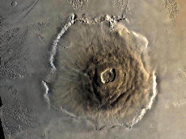 There are very large shield volcanoes on Mars, the largest
being Olympus Mons.
Tharsis Montes and Elysium Planitia regions are rich in old cone volcanos,
averaging over 500 km across and
25 km high. These are ``hotspot'' volcanoes like the Hawaii Islands. The extreme size
is due to the fact that there is no tectonic plate motion on Mars and the lower gravitational
field strength of Mars allows volcanic ejecta to reach higher distances above the surface.
There are very large shield volcanoes on Mars, the largest
being Olympus Mons.
Tharsis Montes and Elysium Planitia regions are rich in old cone volcanos,
averaging over 500 km across and
25 km high. These are ``hotspot'' volcanoes like the Hawaii Islands. The extreme size
is due to the fact that there is no tectonic plate motion on Mars and the lower gravitational
field strength of Mars allows volcanic ejecta to reach higher distances above the surface.

In addition to these features, Mars shows examples of chaotic terrain in the form of highlands
and broken hills. These are probably old tectonic regions. There are also numerous canyons
and long fractured regions. These may be mostly tectonic in origin as well.
Mars is another example of a secondary atmosphere from outgassing (therefore, we know that Mars had an early epoch of tectonic activity). However, unlike the Earth or Venus, the atmosphere is very thin, about 1% the mass of Earth's atmosphere. Its composition is 95% CO2, 3% N2, 2% Ar and less than 1% O2. A high noble gas content implies that Mars' atmosphere was much thicker in the past (noble gases do not react with other elements and are heavy enough to stay within the gravitational field of Mars). The climate on Mars is very desert-like due to its thin atmosphere. There is too little mass in the atmosphere to hold in heat so the warmest daytime temperatures are around 50 degrees F, but the nighttime temperatures are -170 degrees F. Other weather features are massive dust storms and occasional CO2 fog in the canyons.
Summary of Likely Surface Geological Evolution on Mars:
Recent studies have pieced together the following theory: Mars' interior was molten long enough for volcanic activity and potentially a global magnetic field. The event that created the Tharsis region effected the crust of the entire planet by causing it to rotate 20 degrees about it's core. Imagine if you could remove the peel of an orange in one piece and then place it back on the orange. Now rotate it around the fruit. That's what happened to Mars.
There isn't conclusive evidence as to what happened to Mars' magnetic field. The planet could have simply cooled and solidified or large impacts could have disrupted the dynamo effect. Whatever the cause, Mars presently has small magnetic fields in various regions around the planet.