Motion has no meaning with out a coordinate system. Indeed, physics can't be described
without a coordinate system and measurements don't mean anything without a coordinate
system. Events don't occur without a coordinate system because an event is something
that occurs at a specific time in a specific place.
For instance, if you text message your friend the following:
still nothing happens because you have not specified a time, only a location. Hence our coordinate system for events consists of a location plus a time; otherwise known as spacetime.
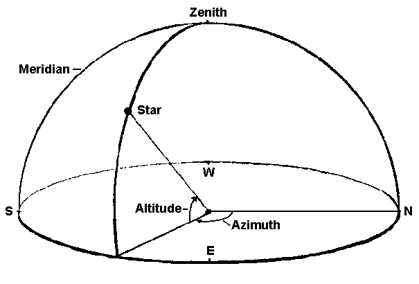
Altitude-Azimuth Coordinates
For an observer standing on the surface of the earth, the simplest possible coordinate
system for observing the motion of a star is shown below:

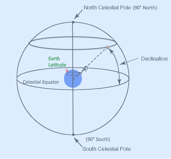
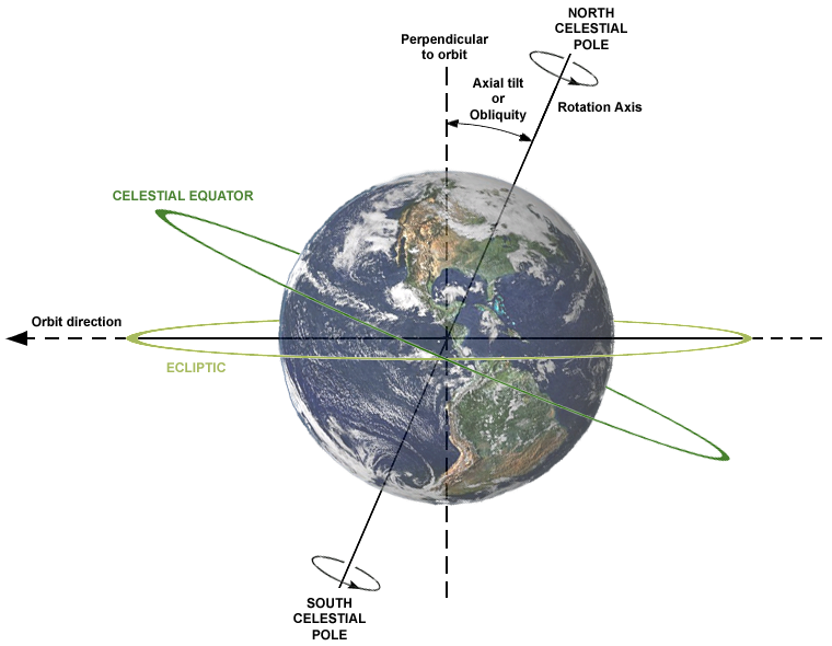
This improved coordinate system defines a celestial equator as a projection of
Earth's equator in the sky. North and South celestial poles are +/- 90 degrees from the celestial
equator. These are also projections of Earth's North and South poles into the sky.
In this coordinate system, an observer at some latitude would observe that any star
reaches a maximum altitude in the sky. That maximum altitude is equivalent to the
latitude of the observer and is known as declination . Thus if you were
on a sailing ship and had a list of declinations of brightstars and measured when
those stars reached their maximum altitude, you would then know your latitude. One particular star convenient for measuring Earth position is the North Star or Polaris. It remains fixed hour after hour, night after night. For
example if you were on Earth and saw Polaris at zenith, you would be located at the North pole. If you saw Polaris at 30 degrees above the horizon, your latitude would be 30 degrees north.
Now for any star reaches its maximum altitude at point lower than the observers
zenith, the latitude is equal to 90 - star altitude + star declination. For example
Suppose you view a star reaching maximum altitude 65 degrees above the horizon,
you know that its declination is 20 degrees north, thus your latitude is: 90 -
65 + 20 = 45 degrees north.
Knowing your longtitude, however, would require a universal time system on the Earth
and that is not established and defined until the 19th century (1884 to be exact). The sky equivalent to
longitude is Right Ascension or RA. This coordinate is divided into 24 hours (no coincidence there) or 360
degrees. There are 15 degrees to one hour. Thus if you stare at one fixed direction in the sky, the stars will
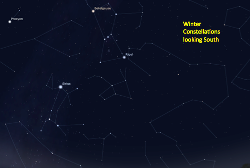
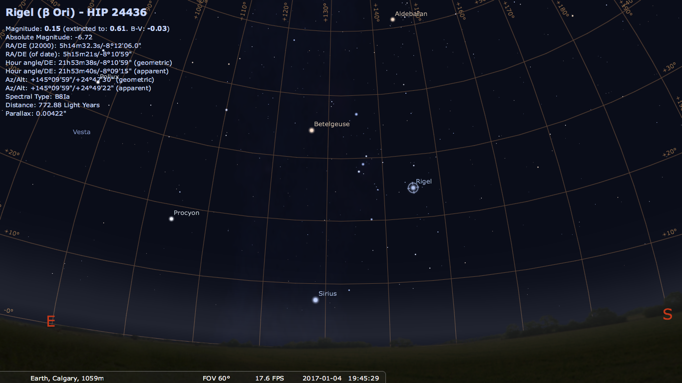
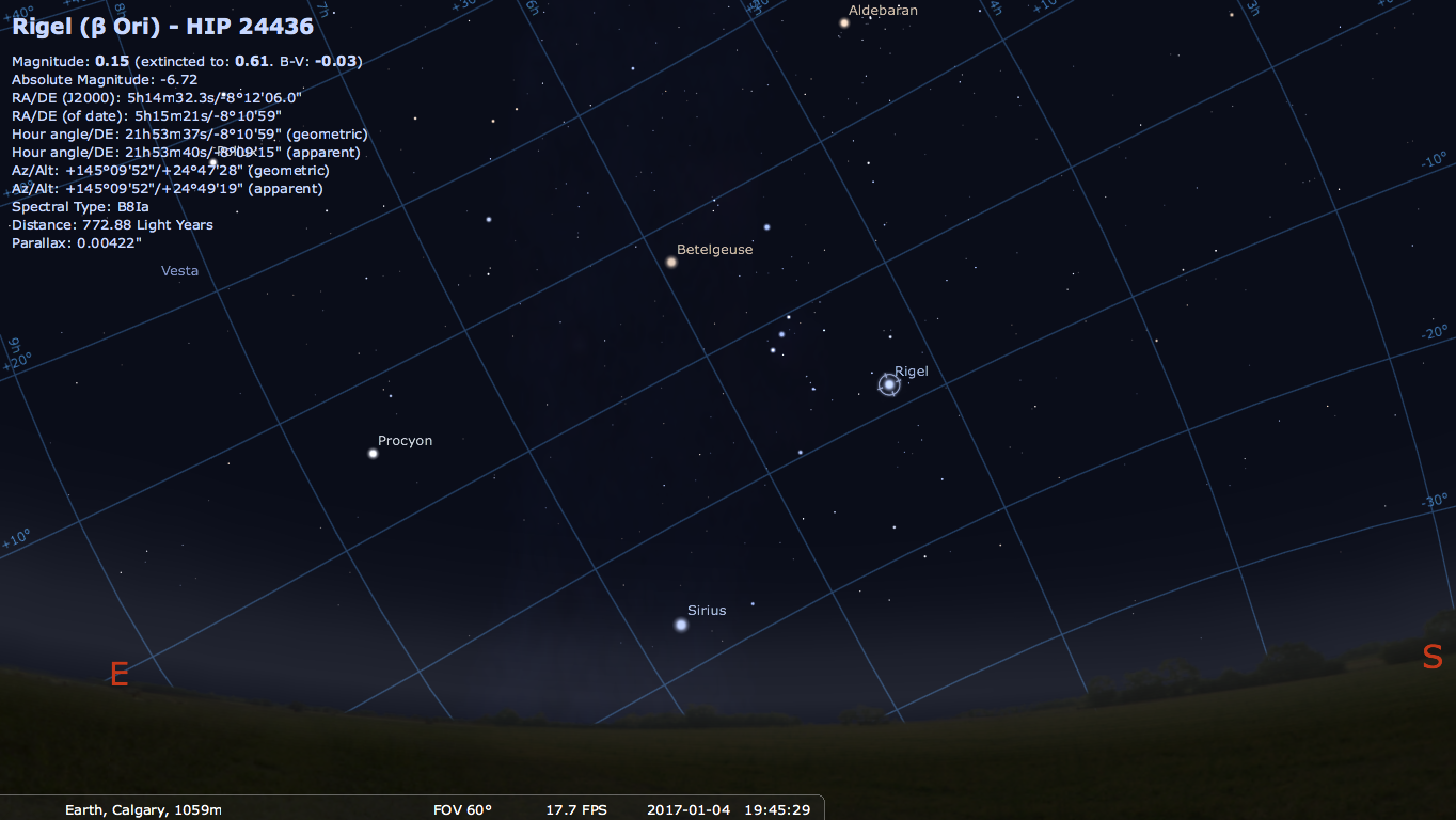
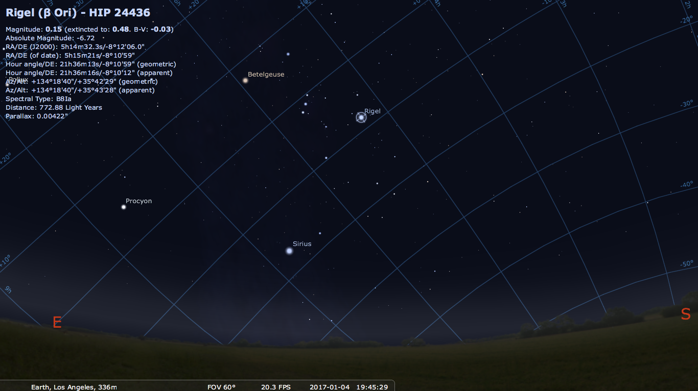
have "moved" 15 degrees in one hour in RA. Below shows Rigel in the RA Dec coordinate system for Los Angeles
and Calgary. Notice that the RA/Dec coordinates are the same for both locations. Yay!
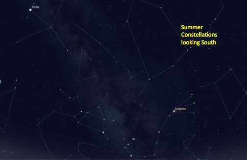
As mentioned, this coordinate system is the most commonly used sky coordinate system for astronomers. Stars
remain fixed to this coordinate grid with small adjustments every 50 years due to Earth's wobble. Yet the Sun
moon and planets do not have fixed RA and Dec coordinates like the stars. And
it still can not explain why the amount of time the Sun spends in the sky varies.
Celestial coordinates are defined as a system where the celestial equator is a projection of the Earth's equator. The Celestial poles are
projections of Earth's north and south pole. Thus any star reaching its maximum
altitude at zenith for an Earth observer
would have the same declination as the observers latitude on Earth.
A simple experiment done initally by chinese astronomers around 1000 BC gives a clue as to why the sun varies
and all you need to do is put a stick in the ground:
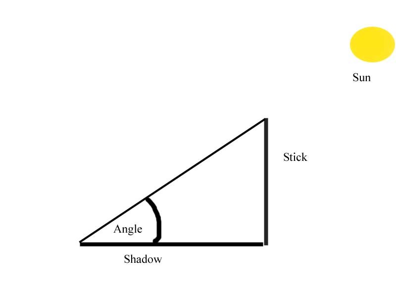
If you do this, you will notice that at solar noon (when the sun is at its highest point in the sky) there is a shadow of a certain length from which you can measure an angle. If you do this long enough (e.g. for one year) you will notice there was a maximum angle measured and a minimum angle measured (this works for any latitude).
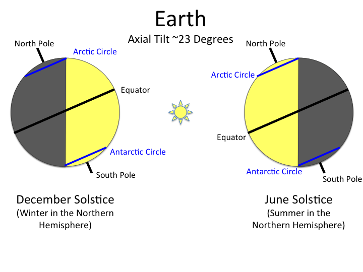
The difference between those maximum and minimum angles will be 47 degrees. This difference is equal to twice the "tilt" of the Earth. Therefore the earth has a "tilt" of 23.5 degrees.
 But a tilt with respect to what?
The correct understanding of tilt requires a different coordinate system
Which establishes the "horizon" as being an extension of the equator of the sun. This is known as the ecliptic plane and we will see later that all of the planets orbit within this plane. Thus the tilt of the earth means that its rotational axis is titled by 23.5 degrees with respect to the equator of the sun (or equivalently, the ecliptic plane).
 |
| Earth's tilt with respect to the Sun at different times of the year (Image credit: NASA/NOAA). |
So from the point of view of an observer on the ecliptic plane, the equator of the Earth is tilted by 23.5 degrees.
Since coordinate systems are often relative then they can be shifted. So from the point of view of the observer on the Earth, the ecliptic plane is tilted by 23.5 degrees relative to the Earth's equator:
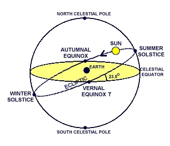
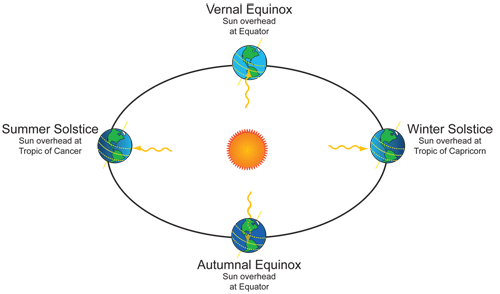
So this means that in the summer solstice the Sun has a declination of 23.5 degrees, meaning that if you were at 23.5 degrees the sun would be directly overhead (e.g 90 degrees above the horizon) at noon.
Now finally, let's consider the case of Eugene, which is at a latitude of about 44.5 degrees.
 |
| Detail of Earth's Tilt at Winter and Summer Solstice (Image credit: NASA blogs). |
Changing Night Sky
As the Earth orbits the sun it moves approximately 1 degree every day. As it moves, midnight which by definition is 180 degrees from the sun, changes direction with respect to an observer in the
ecliptic plane.