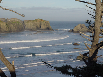
Hey, let's go to the beach! Join us, and take a detailed look at the processes which are working together in the formation and continued evolution of the southern Oregon coast. The course features a 3 day trip to the area for hands-on, real world observations.
The legal stuff...
Course: Geology and geomorphology of the southern Oregon coast (GS170-OC)
Credits: 4 Transfer Credits
Dates: July 10, 2020 (mandatory orientation); July 31 - August 2 (field experience); and August 14, 2020 (journals and projects)
Orientation (mandatory): July 10, 2020 from 8:00 am to approx. 5:00 pm in room E-6 (Redwood campus)
Instructor: Mike Strickler
Enrollment: Twenty (20) students maximum
Description: GS170-OC will take a detailed look at the southern Oregon coast. The course includes a 3 day trip to the area for a detailed and hands-on examination of the region.
Objectives: The purpose of this course is to familiarize the student with the unique geology and landforms of the Oregon coast. Information on plate tectonics, oceanography, petrology, hydrology, and stream processes will be supplied at orientation, as well as during the trip itself.
Length: 5 days, consisting of 1 day of orientation, 3 days along the southern Oregon coast, and a follow-up class to share and turn in journals and projects. Orientation will be held in room E-6 (RWC) on Friday, July 10, 2020, from 8:00 am until approx. 5:00 pm. We will meet in Crescent City, California (next to the giant tetrapod) on Friday morning, July 31 at 9:00 am to begin the field portion of the course.
Travel: By personal vehicle — carpooling is encouraged. Drivers will need to provide proof of insurance at orientation.
Logistics: We will meet in Crescent City on the morning of Friday, July 31, 2020 at 9:00 am. Students will drive their own vehicles; however, carpooling is encouraged and recommended. The class will meet daily from 8:00 am to approximately 5:00 pm. Students will be responsible for their own food and lodging. The field portion of the course will end on Sunday afternoon (August 02). A follow-up session on Friday, August 14 is planned to share and turn in journals and projects.
Click here for a listing of State Parks in Oregon (inc. campgrounds)
Many other public and private campgrounds exist and can be located online. Below is a partial listing. Several are state parks and accept reservations:
Up the Chetco (immediately south of Brookings):
Alfred Loeb State Park (1-800-452-5687): 53 sites
Little Redwood: 12 sites
South Fork: 5 sites
Brookings/Harbor:
Harris Beach State Park (1-800-452-5687)
RV park at the south jetty (next to the Beachfront Inn)
Up the Rogue:
Lobster Creek: 7 sites
Quosatana: 43 sites
Humbug Mountain:
Humbug Mtn. State Park (1-800-452-5687): 40 sites
Cape Blanco:
Cape Blanco State Park: 50 sites
Bandon:
Bullards Beach State Park (1-800-452-5687): ≈100 full-hookup sites, 13 yurts
Driftwood Shores RV Park: RVs (and possibly tent sites)
Near Sunset Bay:
Sunset Bay State Park (1-800-452-5687)
Seaport RV Park: RVs (and possibly tent sites)
Charleston RV Park: RV and tent sites
Prerequisites: None; however, several of the day hikes may be moderately challenging (especially the trail to Rainbow Rock - short, but steep). It is recommended that the student be in relatively good shape if he or she wishes to join in these experiences.
Please note: the ability to complete the hikes is not mandatory to earn a passing grade, but they are strongly recommended if the student wants to gain the full benefit of the course.
Required Text: None
Materials: Various handouts, and topographic and geologic maps of the region. The student is encouraged to research on-line for supplemental information prior to orientation.
Fees: A fee of $50 per student will be required (collected at registration), as will additional money for gas, food, and campsites (or other lodging) during the field portion of the course.
Tentative Itinerary...
Friday 7/10: Orientation, 8:00 am to approximately 5:00 pm (bring your lunch)
Friday 7/31: Meet in Crescent City, California, at 9:00 am
The giant tetrapod (corner of Front and "N", across from Pizza King): Tsunami
Beachfront: sedimentary rocks; faults and folds
Harris Beach: an active continental margin; accreted terrains
Harris South Beach: accreted terrains; mafic seafloor crust; veins and dikes
Night 1: Camp at (or near) Harris Beach State Park
Saturday 8/01: Wander north
Lone Ranch beach: conglomerates
Myers Beach
Port Orford
Cape Blanco lighthouse
Bandon jetty (north): inside a subduction zone
Night 2: Camp at (or near) Sunset Bay
Sunday 8/02
Sunset Bay: sedimentary processes; concretions
Cape Arago: an active continental margin!
Shore Acres: botanical gardens; shoreline processes
Basalt quarry along Hwy. 42: seafloor volcanism
Trip ends at approximately 3:30 pm
Friday 8/14: Meet in E-6 (RWC) to share and turn in journals and projects (9:00 am until ?)
Click here to download the maps